I’m delighted that there’s been a twenty year trend in the United Kingdom for free and open access to more and more government data. Information about the public that has been largely collected at taxpayer expense should be made as widely available as possible, in open, machine- and human-readable formats.
So I’m especially proud that it’s a Liberal Democrat peer who is making the latest push for regular publishing of the Postcode Address File, the Royal Mail dataset of every address in the country.
The gradual release of more and more public data has been great for technical innovation in the UK. We’ve been able to do some pretty neat things with it, and we’re far from alone.
After years of refusing to make data available for free, the Ordnance Survey finally began to release some map data as well as co-ordinates for every postcode in the country in 2010. This was a major step forward for innovation in the sector and we use the data extensively in our Lighthouse membership management platform for the Liberal Democrats, in particular for assigning members and supporters to local parties, something that just wouldn’t have been possible in the past within the budget available.
The OS also now provide every administrative boundary in the country, from parliamentary constituencies to council wards free for everyone to use. Without this, we couldn’t have assembled maps of each of the Lib Dem’s local party structures which had widespread changes thanks to new Westminster constituencies coming in to play later this year.
We’ll be working this year to bring further improvements to our affordable and popular email your MP service, which just wouldn’t be possible without these two datasets.
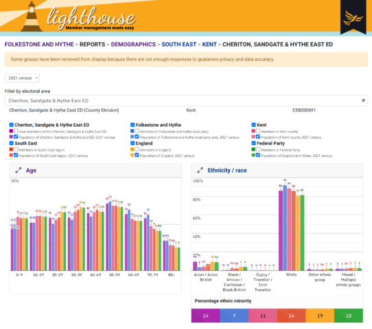
The Office for National Statistics publishes summary reports of census data 2 years after the census takes place, allowing us to provide the Lib Dems with innovative visualisations of how well their membership and officer demographics reflect the diversity of the population in each area of the country.
Full results of general and by elections are made available by the House of Commons Library which has also come in handy for drawing the occasional bar chart.
But the government has been stubborn about the Postcode Address File. In the last review in 2006 the proposal to make the data available for free was rejected in favour of continuing to profit off its licensing.
For the time being we use Loqate to provide address lookup on our websites. And it’s a great product. But free use of the data could save our customers considerable ongoing cost, and we could do offline validation that just isn’t possible at present, for example to clean up large existing datasets of user addresses in bulk, as well as providing more accurate and simpler geolocation to clients. Location data at the address level is also more accurate than the postcode level information we currently have to rely on.
Government has a duty to promote Open Source and Open Data, and I hope the House of Lords will take the opportunity to deliver on this responsibility as the Data Protection and Digital Information Bill passes through the chamber.